
For buyers · Cape Coral boating
Will my boat fit at this Cape Coral waterfront home?
Start at the dock for the exact address. Trace the water connection to your destination, then compare the route, slip and lift with your boat’s dimensions. A freshwater canal can be a great choice for lake boating. If your goal is the Caloosahatchee River or the Gulf, you need a connected route with enough overhead clearance and water depth for your boat.
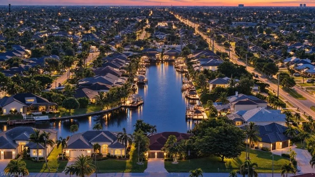
Where do I want to take the boat from this address?
Mark the property and your destination on the City of Cape Coral canal maps. A trip around Lake Kennedy and a trip to the Caloosahatchee have different requirements. For a Gulf-access listing, trace each segment to open water and identify fixed bridges, crossings, or operating structures along that specific route. An aerial photo of open water nearby cannot establish the connection.
Source: City of Cape Coral maps, including freshwater and saltwater canals ↗
Which boat measurements should I bring?
Bring the model and year, overall length including extensions, and beam at the widest point. Air draft is the height from the waterline to the highest point in the configuration you plan to travel in. Loaded draft is the depth below the waterline to the lowest part of the loaded boat. Include antennas, hardtops or towers when discussing overhead clearance. Record units and leave any measurement you still need to verify open.
Source: NOAA Office of Coast Survey electronic navigational charts ↗
How do water levels affect a fixed bridge or a shallow approach?
Higher water generally leaves less room under a fixed bridge. Lower water can expose a depth limitation near a private dock or shallow stretch. Look up the charted clearance, its reference water level and the relevant tide or observed water level. The NOAA Fort Myers station gives regional context. A marine professional should verify the controlling bridge and the shallowest point for this address and your boat.
Sources: NOAA Office of Coast Survey electronic navigational charts ↗ · NOAA Tides & Currents at Fort Myers, station 8725520 ↗
What needs to match at the dock and lift?
Ask for usable slip width and length, approach and turning space, the lift’s model and rated capacity, and its service records. Check the boat’s weight with fuel, engines, and equipment in the configuration you will lift. Ask the lift manufacturer or installer to confirm suitability and have a qualified marine contractor evaluate the installation. A listing’s advertised lift rating is one piece of that review.
Source: Golden Boat Lifts, estimating vessel weight for a lift ↗
What can Noah check before I make the trip?
Send me the listing, your usual destination, and any boat specifications you already have. I can identify the route questions, request available dock and lift records, and organize what still needs confirmation before you tour or make an offer. Review current charts, Coast Pilot guidance, and local navigation notices with a qualified marine professional for passage conditions. This worksheet is for choosing a property.
Source: NOAA U.S. Coast Pilot, coastal waters and channel guidance ↗
Will my boat fit? Property worksheet
Start with the address. Add your destination and any measurements you know. You can review the notes here before deciding whether to share them with Noah.
Your property review notes
Information to confirm
What to bring to an address-specific review
- The property address or listing link and your usual boating destination.
- Boat model, length overall, beam, air draft and loaded draft, with units.
- Loaded weight if you intend to use a lift, plus its model and capacity if available.
- Any named crossing, narrow turn, shallow stretch or dock feature you want checked.
- What a seller, installer, or qualified marine professional has confirmed and when.
Sources and further reading
- City of Cape Coral maps, including freshwater and saltwater canals ↗
- NOAA Office of Coast Survey electronic navigational charts ↗
- NOAA Tides & Currents at Fort Myers, station 8725520 ↗
- NOAA U.S. Coast Pilot, coastal waters and channel guidance ↗
- Golden Boat Lifts, estimating vessel weight for a lift ↗
Sources checked November 7, 2026. Charts, water levels and notices change. Verify the specific route and installation before making a boating decision.
